Biodiversity
The Biodiversity refers to the variation in shapes, colours and behaviours among living beings within the Earth, allowing the combination of multiple forms of life, result of billions of years of evolution, and interactions with its environment, including human activities. Ecosystem is known as their relationship between a community of living beings and the physical environment they need so as to live adequately.
The nearest countries to the Equator are the most bio diverse on the planet because they receive more sun energy throughout the year. To determine the level of biodiversity they are taken as indicators the following factors: species diversity, such as the number of species inhabiting certain area, genetic diversity, which refers to the degree of difference between species and between individuals of the same species, and ecosystem diversity, which deals with the interrelations between individuals and populations of different species and their relationship with the environment they inhabit.
The Life Zone is a group of ecosystems on a particular part of the planet, which share the same climate, vegetation and fauna, vegetation types or biomes. All the Life Zone areas in the world form a functional unit called the biosphere, a great living being, able to regulate certain aspects of its state and evolution.
It is extremely important for a country to know their biological resources so as to establish rules for its conservation and efficient management, and therefore know how to exploit its huge potential, such as the development of ecologically sustainable tourism which benefits local economies.
BIODIVERSITY IN COSTA RICA
Costa Rica is located in the northern hemisphere, midway between the Equator and the Tropic of Cancer, on the South of Central America, bordered on the North for 300 km by Nicaragua and on the Southern border for 363 km with Panama, on the West by the Pacific Ocean and on the East by the Caribbean Sea.
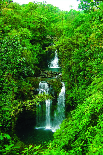
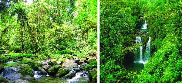
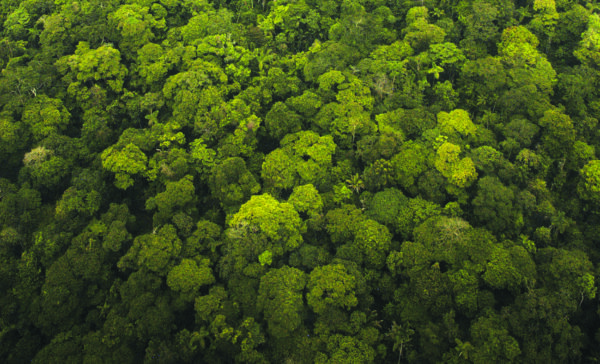
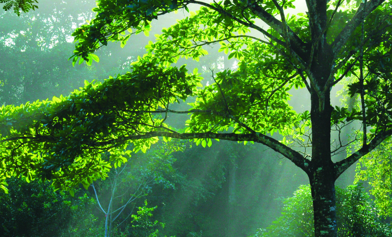
Costa Rica has 51,100 squared Kilometres, the 0.03% of the global area and is considered one of the 20 countries with the greatest diversity of species, since it has about 4.5% of known species. About 25% of the territory is protected within a conservation area. From its origins as an Isthmian territory Costa Rica has been a biological bridge where species of flora and fauna belonging to neo Arctic, the neo tropics and some of the Antilles coexist. The country has a dense vegetation rich in diverse species. Its forests cover 1/3 of the country’s surface.
These forests are home to about 12,117 plant species, including more than 1,300 orchid species and 2,000 tree species. They are home to over 230 mammal species, being 207 terrestrial and 23 aquatic, of which 21 correspond to cetaceans, including whales, dolphins and manatees. They have a range of about 850 bird species, of which about 625 are residents and 225 are migratory. Among the amphibians you find more than 180 species, 250 reptile species and over 150 freshwater fish species.
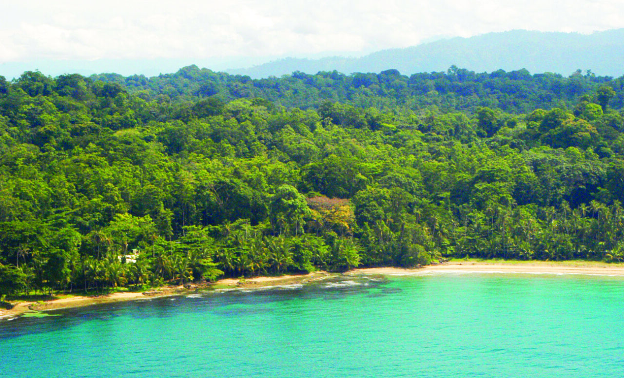
BIODIVERSITY IN THE CARIBBEAN
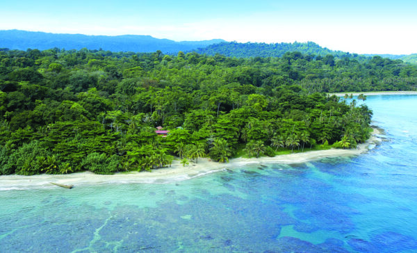
The Caribbean of Costa Rica is located in the province of Limon and its geographical location is within the tropical zone. It is an area dominated by abrupt mountains, hills, numerous rivers, vast flood plains and a coastline of 212 km. on the Caribbean Sea.
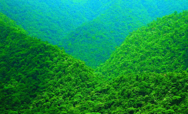
Because the altitude range is very wide, you find different Life Zone areas, with very different landscapes ranging from coastal sea level to landscapes of moorland above 3,000 meters altitude. This has established a number of microclimates and a great influence on biodiversity, highlighting the high number of animal and plant species and the variety of ecosystems.
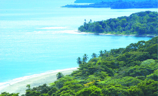
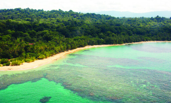
The Caribbean has more than 40 natural protected areas among which you have the National Parks of Cahuita and Tortuguero National Park, the National Wildlife Refuge Gandoca Manzanillo, Barra del Colorado, Hitoy Cerere or Indian Reserves of the Talamancan mountain range. We should also mention the beaches of the southern Caribbean as the most beautiful of Costa Rica, including Punta Cahuita and Puerto Vargas, with a unique coral reef, and also the Puerto Viejo, Cocles, Chiquita, Punta Uva and Manzanillo or the wild Punta Mona.
The population of the Caribbean is as varied as its nature; there is a mix among the original inhabitants of Talamanca, the Cabecar and Bribri, with the Afro-descendants, the ethnic Chinese and whites. Apart from speaking Spanish each community has preserved their languages. In this region of the country has forged a cosmopolitan culture with a strong respect for nature, stimulating the development of small tourism businesses focused on a sustainable tourism with a high environmental and cultural commitment.
GEOGRAPHY
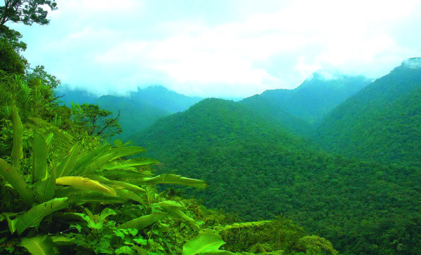
In the Talamancan mountain range we find the most antique and prominent mountains of the Caribbean region landscapes, where it is evident that their tops were covered by glaciers in the last ice age, formed by volcanic and sedimentary rocks during the Tertiary era and whose rise was due to the pressure on the Coco plate moving eastward against the Caribbean plate.
The Talamanca mountain range has a length of 180 km., starting at the Central Valley with a northwest-southeast orientation, with two perpendicular rows to the axis, one towards the Pacific and the Matama Row, a gentle slope towards the Caribbean sector, and continues in the Republic of Panama under the name Cordillera of Chiriqui. It has peaks over 3,000 meters. high, as the Cerro de la Muerte, Cerro Kamuk and Cerro Chirripo, the highest in the country, with 3820 meters.
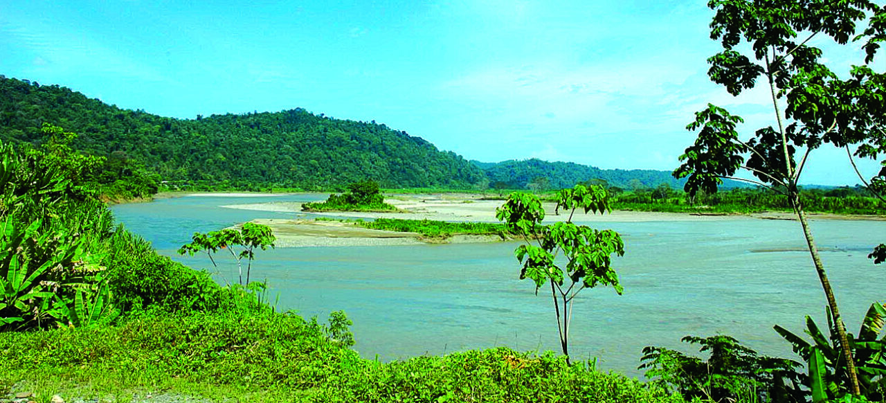
The Caribbean region was formed with material from volcanic eruptions, and alluvial sediments supplied by rivers that descend from the Central mountain range, which formed the northern plains, the lowlands of Limon and the Caribbean coast. They are flat lowlands, which taper towards the south until they disappear in Cahuita.
The Estrella Valley is an inter-mountain valley, bordered by the foothills of the Row of Matama and the Talamanca mountain range, with a declining slope towards the coast of Cahuita. To its south you find the extensive fluvial valley of the Sixaola River, where the rivers Telire, Coen, Lari, Uren and Yorkin converge. This area is known as Talamanca valley or Baja Talamanca, a flat area surrounded by hills with lush vegetation.
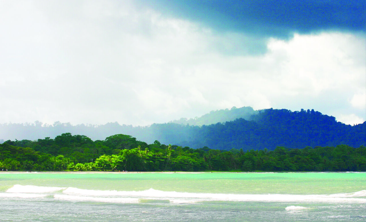
The Atlantic coast is characterized for being straight, with a length of 212 km., which runs from Punta Castilla, at the mouth of San Juan River to the Sixaola River. The north coast has sandy beaches and estuaries, the central sector consists of rocky outcrops of coral origin with some sandy beaches, and in the South Caribbean you find beaches protected by coral reefs, habitats for a rich diversity of marine species.
HYDROGRAPHIC BASIN
The slope of the Caribbean has a complex watershed network, long and wide rivers descending from the mountains to the Caribbean with quite a flow due to frequent rains, traversing in its inferior course extensive plains where there are frequent changes in courses, forming meanders and canals that intercommunicate the rivers.
Among the major rivers of the Atlantic side we find the San Juan River, which marks the international border with Nicaragua and distributes its water to the Colorado River, receiving waters of the Sarapiqui River and the Tortuguero River forming a canal network, navigable lagoons and picturesque flood plains.
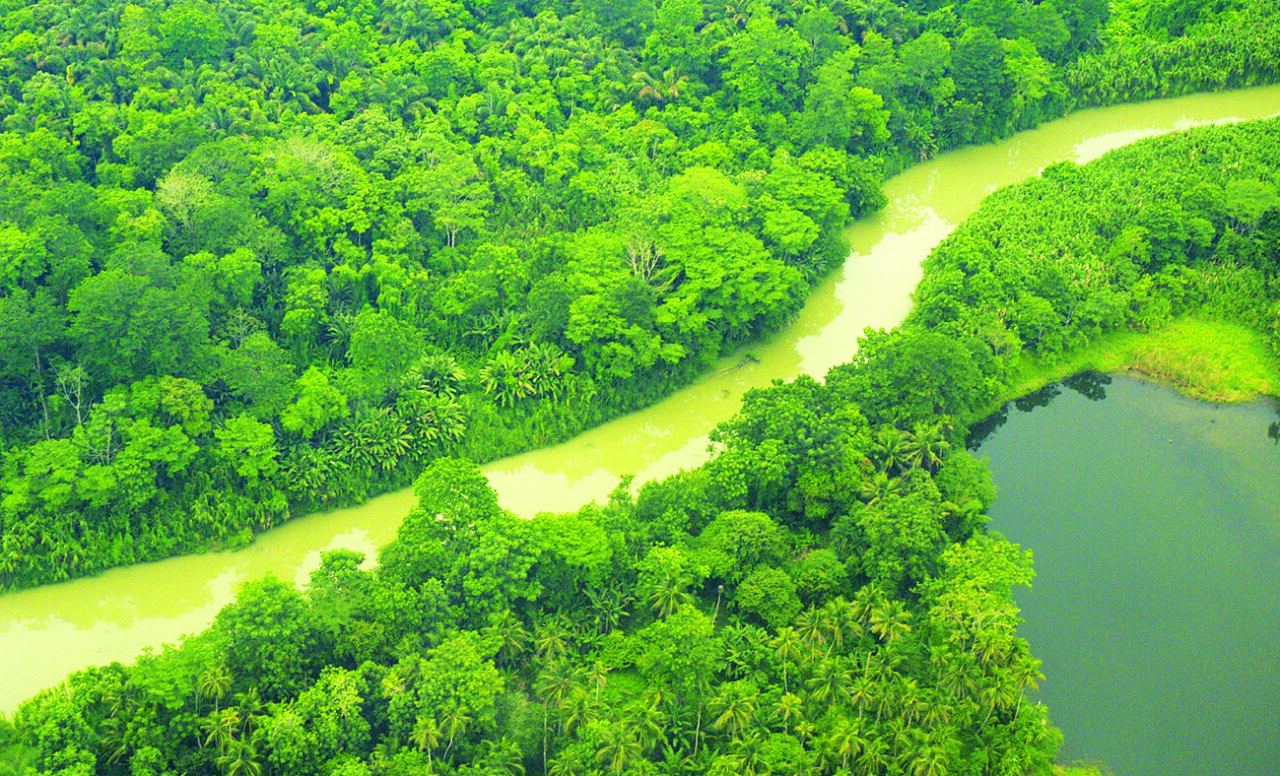
The rivers that descend from the Central mountain range towards the northern lowlands form one of the most extensive river networks in the country. The River Reventazon shares its waters with the Parismina, the river Pacuare and the Matina and Chirripo rivers. South of Limon you have the rivers Estrella and Banano that originate in the Matama row and the Sixaola River collecting the waters that come down the Talamancan Valley being a natural border with Panama.
CLIMATE
The essential components to determine the weather are temperature and humidity, which vary depending on solar radiation, atmospheric pressure, wind, humidity and precipitation, which can be modified by other characteristics such as vegetation, topography or proximity of water bodies.
Because of its tropical location the temperature in the Caribbean does not suffer drastic changes, while maintaining thermal stability throughout the year where if it presents important variations in temperature it is depending on the altitude range from sea level to over 3,000 m . On the coast, temperatures range between 28 ° and 37 ° C., in the lowlands it doesn´t descended from 20 ° C. and the maximum rarely exceeds 35 ° C., however in the higher altitudes of the Talamanca mountain range low temperatures throughout the year have an average of 10 ° C., which may even fall below 0 ° C. in the months of November and December.
The rainfall regime is marked by the influence of the northeast trade winds, cold air masses crossing the Gulf of Mexico or that come down from the U.S. east coast causing anticyclones, with cold humid winds that carry lots of rain to the coast and plains for periods up to 15 days. Other storms which last few days are called Tropical Waves, which are due to east winds that move high in the atmosphere and cause persistent rain.
In the Caribbean there are no dry areas and it also doesn’t have a dry season, although it presents a remarkable low rainfall during March-April and August to September, sometimes October, while in the mountains it rains all the year round without significant disruptions.
The climate classification is based mainly on two parameters, the average temperature and annual precipitation. It is also important to indicate the presence or absence of dry season. It is tropical if it has a dry season and equatorial if it has not. So based on these three factors we can speak of a Very Hot Humid Equatorial climate in the plains of the Caribbean. In the highlands there are however very wet and cold rain regimes, where humidity is considered as the form of water vapor in the air.
Fotografias de Paco Salmerón
Texto de Juan Carlos Lorite y Paco Salmerón